
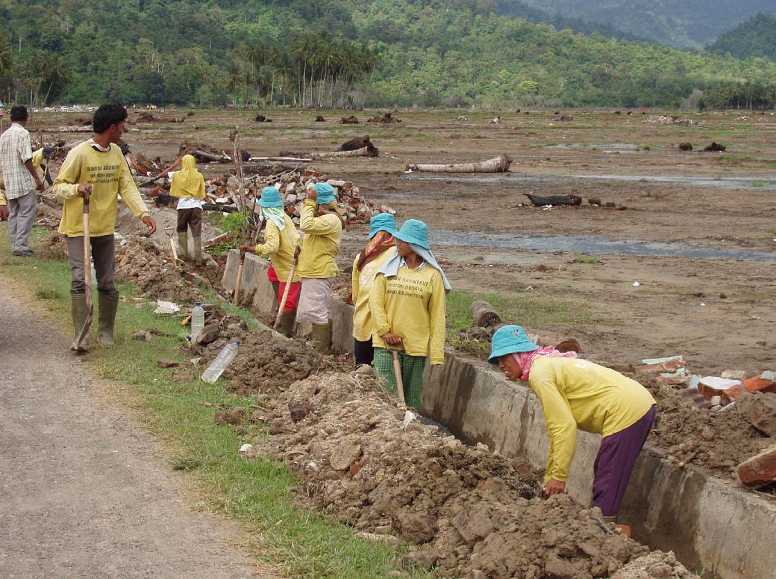
Mapping Hazards
in
Banda Aceh
INDONESIA
Source: BBC
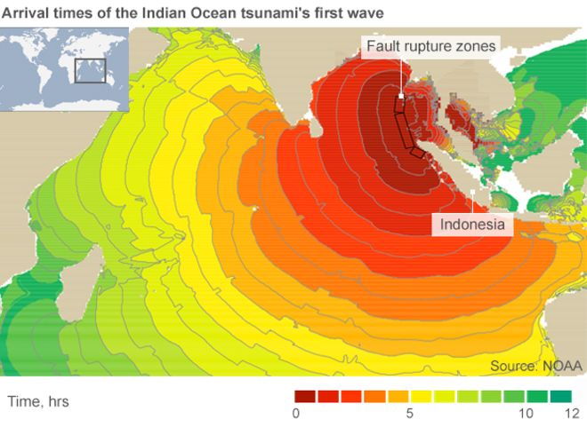
Witness the 2004 Indian Ocean tsunami - it was widely reported that a devastating magnitude 9.0 earthquake caused the tsunami. The number 9 of course refers to the Richter Scale which provides a logarithmic measure of the magnitude of the energy released at the earthquake epicenter.
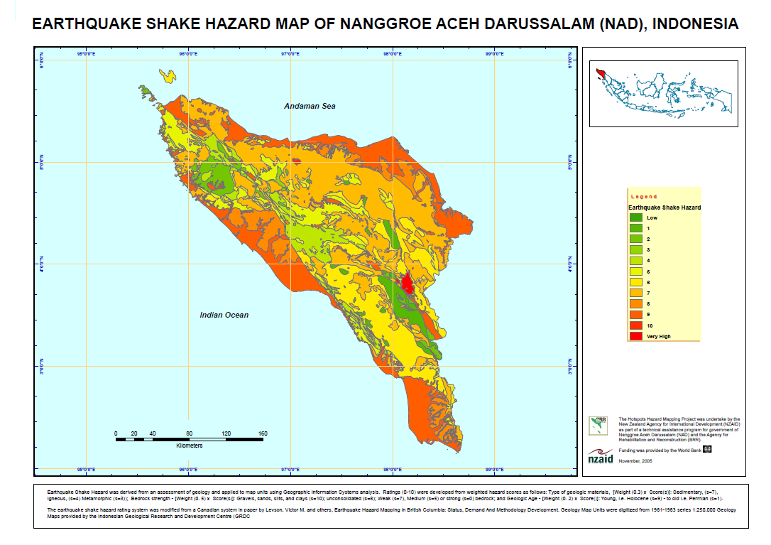
A less familiar measure of eartquakes is the Mercalli Intensity Scale which more accurately measures the "effects" of an earthquake as "felt" or as recorded at a specific locality. Earthquake Shake Hazard Maps help to predict which areas will shake more violently and longer - like a "bowl of jelly" - as opposed to land areas with a firmer geological structure.
Constructing shake maps requires expert analysis of geological, soils and topographic data.
Source: mauricebowen.com
A team of international experts were recruited with expertise in earthquake-resilient engineering and hotspots mapping of disaster-prone areas. Maurice Bowen was selected through international competitive bidding due to his expertise in geosciences and geomatics and his experience in the region.
Within 45 days of arrival he had prepared a dozen interpretative and thematic maps depicting shaking intensity, flooding risk and landslide hazards to vulnerable communities. The maps provided a framework for more detailed studies aimed at disaster planning, response, and mitigation.
(1)Methodology: Levson, V., Matysek, P., Monahan, P. and Watts, B. (2018). EARTHQUAKE HAZARD MAPPING IN BRITISH COLUMBIA: STATUS, DEMAND AND METHODOLOGY DEVELOPMENT. [online] Empr.gov.bc.ca. Available at: http://www.empr.gov.bc.ca/Mining/Geoscience/PublicationsCatalogue/Papers/Documents/P2003-02_06.pdf [Accessed 11 Sept. 2005].

Pipeline Routing
in
Central Java
Source: onepetro.org
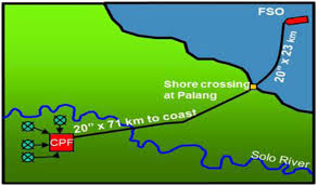
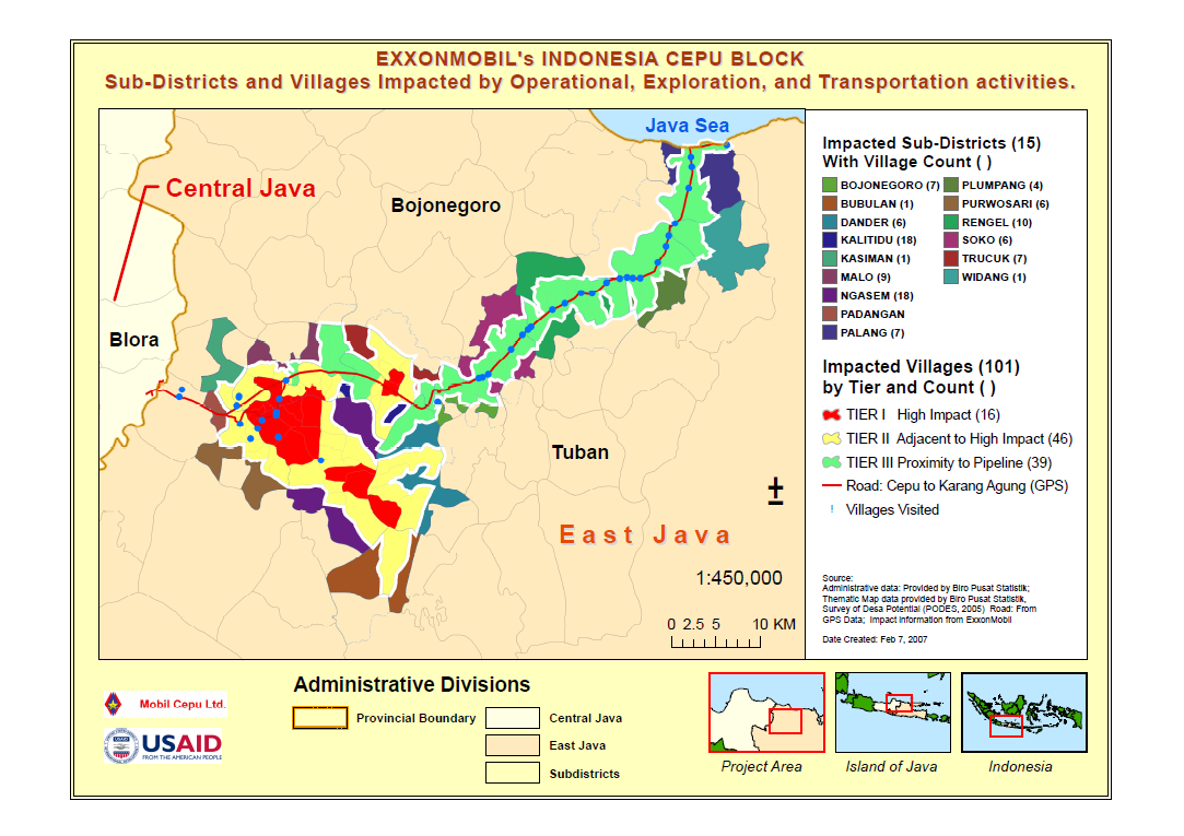
In 2007 EXXONMOBILE was faced with the task of routing a 75km oil pipeline from a well in Central Java, Indonesia to a Floating Storage and Offloading (FSO) coastal facility.
The only route was through crowed villages and towns. An evidence-based analysis of potential socio-economic and environmental impacts was required. Importantly EXXONMOBILE also needed a way to effectively communicate how they planned to minimize these impacts.
Source: mauricebowen.com
The strategy employed was to stratify impact zones according to the level of impacts along the proposed route. Advanced Geospatial and Cartographic techniques were used to produce a map clearly depicting high and low impact zones area.
The Geospatial overlay and routing analysis also required the compilation of data from many sources including GPS ground control.
Community-Based
Recovery
in
INDONESIA
Source: mauricebowen.com
The assistance was delivered under two projects: 1. Support for Peace and Democratizaton (SPD), and; 2. Aceh Community Empowerment and Ownership (ACEO) and implemeted by Development Alternatives Inc. (DAI).
Implementation required an evidence-based approach for selecting beneficiary communities as well as reporting on project success.

Source: mauricebowen.com
A key outcome of that effort was the production of a variety of tabular reports and cartographic products such as the "story-book" map shown at the left.
This particular product combined images, statistical data and cartography to emphasize gender maintreaming in SPD and ACEO.

Web Apps
for
Geoscience
in
The Northwest Territories,
CANADA
Source: ntgodata.nwtgeoscience.ca
A suite of public-facing legacy web apps had been highly customized to accommodate multiple data formats such as Oracle Spatial, ESRI Geodatabases/shapefiles in a variety of projections, excel workbooks, as well as out-dated file formats which complicated the task.
Decades of investments in geoscience data, including the world's largest diamond database, was in jeopardy.
Also, public access to 150,000 scientific publications and terabytes of spatial/non-spatial data existed, dating back to the early 1990s urgently needed better management.
Source: NTGS Web Apps
Working over a period of 5 years, as a Web GIS and Database Specialist, the Web applications were modernized under a program that was severely contrained by a lack of financial and human resources. The strategy was to find and recruit key consultants who had been involved in the design and development of the legacy system.
Despite these contraints, the project benefited from (1) on-boarding of senior management; (2) selection of an architecture and development framework that was manageable and compatible with local agencies, (3) careful selection of external consultants, (4) spirited teamwork, and importantly; (5) consistent, meaningful collaboration with NTGS partners in government, industry and academia who provided invaluable guidance.
The outcome, a set of new web apps, as described in this ministerial press release can be viewed at this link: Northwest Territories Geological Survey (NTGS) Web Applications.


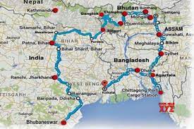
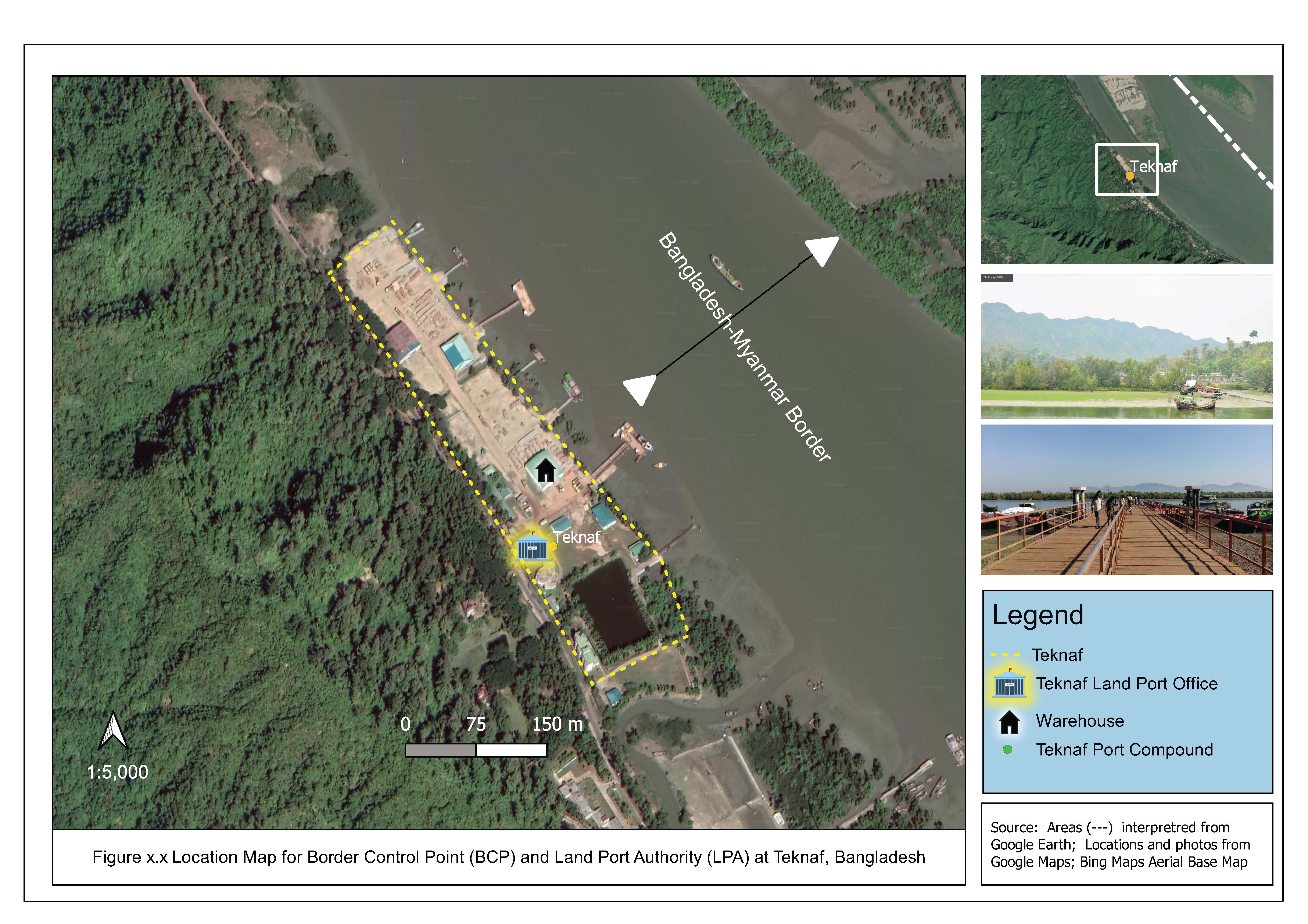
IT/GIS Services
for
Border Management
in
BANGLADESH
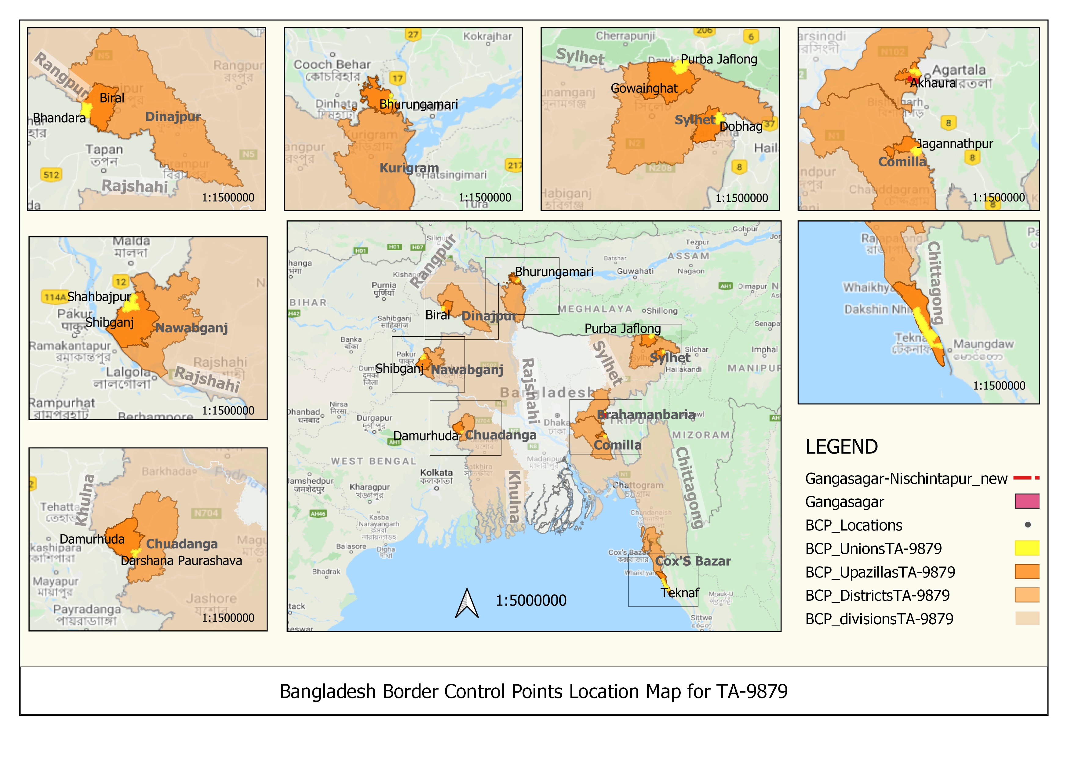
Source: mauricebowen.com
The project objective was to improve Bangladesh's border crossing infrastructure at nine border crossings points (BCPs) and provide a central customs warehouse (CCW), and a Regional Training Centre (RTC).
Infrastructure upgrades aimed at improved performance, reduction in border crossing times and provide better predictability and transparency for Bangladesh's supply chains.
The outcome is expectred to reduce transport costs and lead to increased export volumes. UN ESCAP estimates that partial implementation of cross border paperless trade could boost Bangladesh exports by 13%.
 Source: mauricebowen.com
Source:
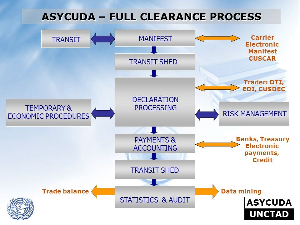
1. https://unctad.org/topic/transport-and-trade-logistics/customs-automation-ASYCUDA
2. https://asycuda.org/en/
Working remotely, coordination with National GIS/IT staff was conducted via virtual MSTeams/Zoom meetings to successfully complete site surveys and scoping missions.
Phase I entailed locating, mapping, assessment and documenting current administrative setting as well as the resources, systems, and business processes in use at over a dozen BCPs bordering India and Myanmar.
Phase II work components related to the assessment and reporting of the GIS/IT Architecture were prepared using an agile System Life Cycle Approach, and Business Process analysis.
AS-IS and options for a TO-BE modern IT architecture were prepared and costed with considertion to the needs of Bangladesh custom authorities and which aligns with the propsoed the UNCTAD's ASYCUDA system.

IT/GIS/Database Services
for
A Road Connectivity Master Plan
in
NEPAL
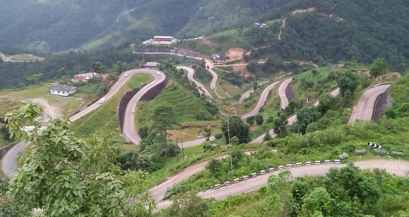
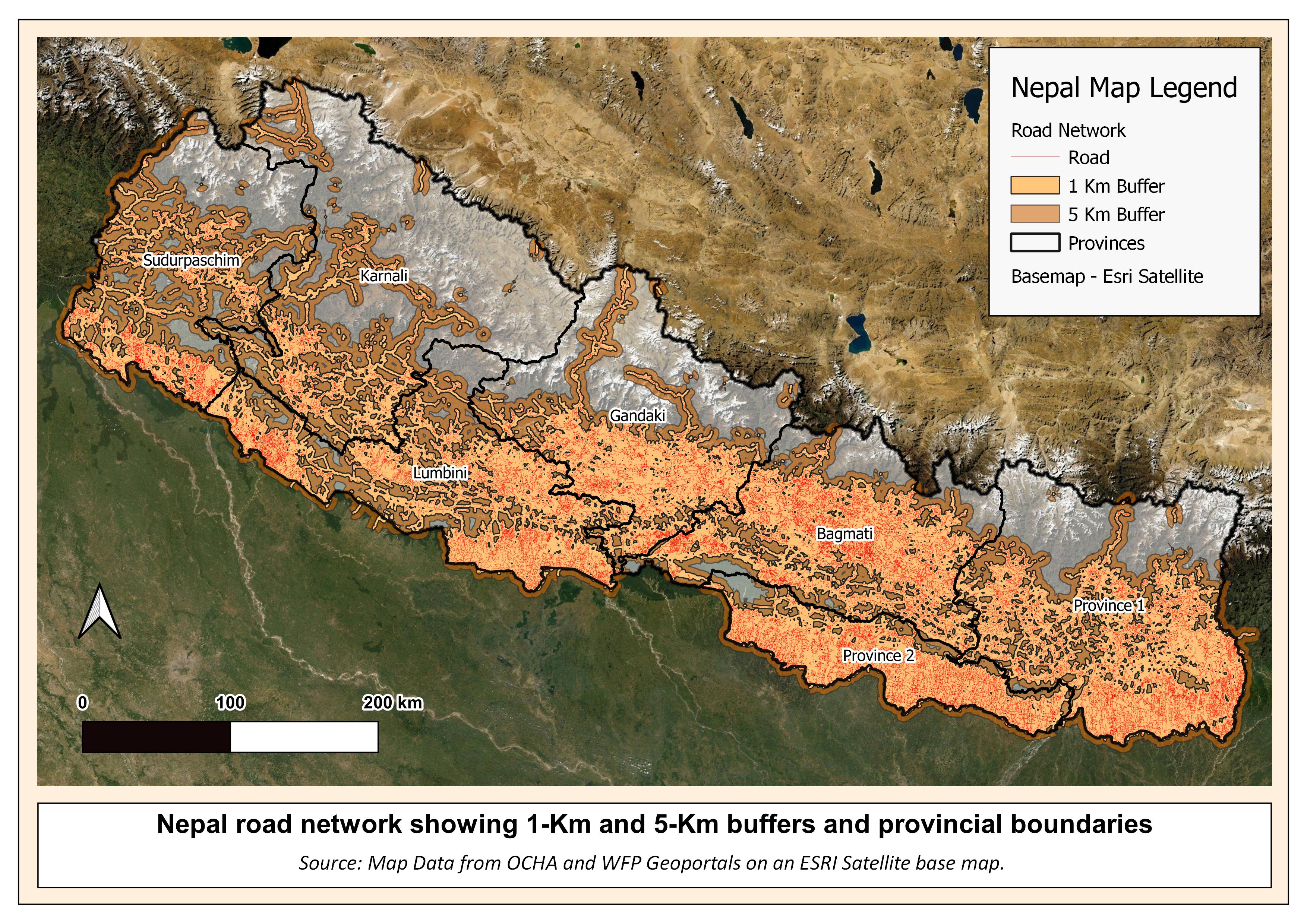
Source: mauricebowen.com
- improved infrastructure for private sector-led growth,
- improved access to devolved services, and
- environmental sustainability and resilience..
- Sourcing National, Provincial and Municipal datasets,
- Development of automated extraction of travel times and distances using the Google Map Application Programming Interface (GMAP API)
- Working in cooperation with Road Engineers to develope an improved databases and user interface for the Nepal Highway Management Information System (HMIS)